
One of the main users of products derived from remote sensing data is nature conservation. Remote
sensing can be used to map large areas, even in places where on-site visit is not possible. We have
provided products obtained from remote sensing data for the observation, analysis and visualization
of several phenomena across the large operational area of national parks that cannot be carried out
with traditional techniques or only with large resource needs.
For more than ten years, our company has been providing remote sensing data and various services
and products derived from the data to the National Parks of Hungary. Almost all remote sensing
technologies have been applied in the field of nature conservation. One of these technologies is
aerial hyperspectral remote sensing, which we have successfully used to map invasive weeds in the
Central-Ipoly Valley and grassland species in the Hortobágy area. Hyperspectral technology can even
be used for species-level identification in mapping large areas.
A great deal of reconstruction work is being done to conserve habitats and create new habitats, for
the planning tasks of which the most effective method is the use of a topographic models created
from aerial laser scanning of the area. In the Hortobágy National Park, a comprehensive terrain
model of the former bombing range area, while in the Fertő Hanság National Park, a comprehensive
terrain model of the Hanság area were created. High-resolution topographic models are effective
tools for water and landscaping planning tasks. In addition to habitat mapping and planning work,
topographic models were also created for demonstration purposes, from which even 3D printed
terrain tables can be produced. On behalf of the Aggtelek National Park, we have produced various
maps to study the habitat and migration routes of large carnivores, which can be integrated with
maps and databases produced using similar technology in neighboring countries. The maps help to
understand the characteristics of the areas visited by wolves and bears. A further use of the terrain
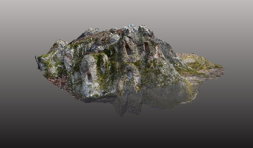
models is the identification and delimitation of archaeological sites in National Parks. A special task
was to create an accurate 3D model of the hive-stones, using an integration of ground-based laser
scanning and airborne remote sensing.
The results of the aerial laser scanning carried out in the Bükk National Park have created an accurate
database of the kurgans and the analyses have also led to the discovery of new sites. With high
accuracy, up to 20 measurement points per square metre, airborne laser scanning can map up to
100km 2 per day. This year we carried out airborne LiDAR measurements in the early spring leafless
period in the areas designated by the Danube-Ipoly National Park in Börzsöny. The data can be used
for a wide range of applications, from individual tree-level studies to study field geomorphology.
Uncategorized
Spending ten years in the service of national parks
16
ápr
ápr