
In the past two decades, several flood records have been broken in the Danube River basin,
consequently in Hungary as well. High water levels and fast-flowing flood waves pose serious
challenges for water specialists, as a flood wave brings with it economic, social and environmental
risks. The condition assessment of the constructed defense lines and flood protection dikes will be a
priority in the protection, especially in the prevention. Modern measurement methods create new
opportunities to assess the state of the environment, and to learn more about flood protection dikes
and their surroundings.
The international project „Complex flood-control strategy on the Upper-Tisza catchment area –
DIKEINSPECT”, coordinated by the University of Miskolc, aims to develop an innovative methodology
to support flood protection tasks, based on modern technologies, primarily geophysical, soil
mechanics measurements and the use of aerial remote sensing data. The project involves Hungarian,
Slovakian, Ukrainian and Romanian experts and focuses on the development of new flood protection
strategies, including novel methods using sensor data and predictive modeling.
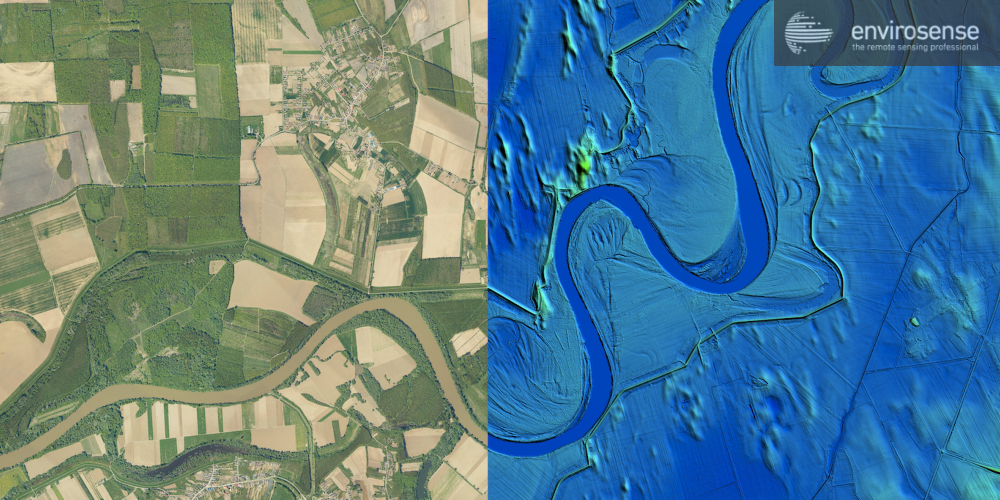
Our company also contributes to the success of the project with its remote sensing equipment, in
close cooperation with the geophysical experts of Geogold Kárpátia Ltd. High-accuracy topographic
models produced by aerial laser scanning play a major role in flood modelling. An important factor in
assessing the spread of water leaving the riverbed is the examination of surface roughness, which
can be achieved by identifying the landcover categories. Our high-resolution orthophotos and
satellite image processing algorithms provide the basis for this.
Uncategorized
Remote sensing data in the service of flood protection
16
ápr
ápr